Jamaican Geography


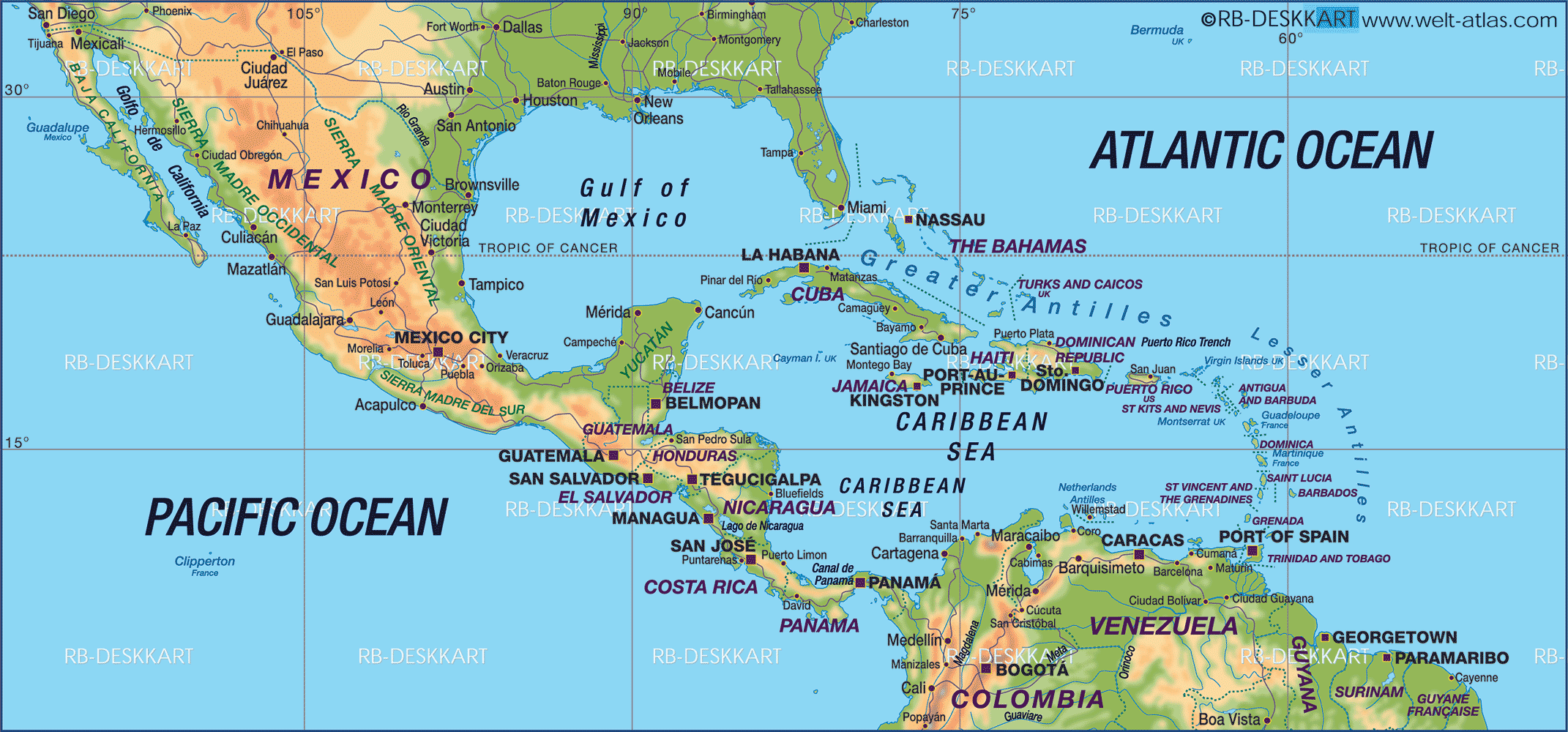
Jamaica is an island surrounded by the Caribbean Sea. It is positioned at approximately 18 degrees North (Longitude) and 77 degrees West (Latitude). The nearest point of the North America to Jamaica is the Florida Cays, which is approx. 240 km to the north of Cuba. Jamaica lies 160 km (100) miles west of Haiti.
Trinidad and Tobago and The Lesser Antilles has many links of trade and culture with Jamaica, and is positioned at 1600km (1,000 miles) to the east and south-east coast. To the south-west coast of Jamaica, a large area of shallow sea extends for over 160 km (100 miles) over the Pedro banks, with their associated cays. The Morant Cays are 51 km (32 miles) south from the eastern extremity of Jamaica at Morant Point.
The most significant feature of Jamaica is the mountainous nature of its surface. About half the island is over 300m above sea level. The plains and valleys lies mostly to the southern side of the island.
In case you are wondering, Jamaica is just perfectly located, and has the weather and climate many countries only wish they had.

 (1 votes, average: 3.00 out of 5)

Pingback: Accommodations in Port Antonio - About Jamaica
Pingback: Jamaican Fauna: Invertebrates - About Jamaica
Pingback: Sports in Jamaica - About Jamaica